Showing posts with label Local. Show all posts

Wednesday, 4 December 2013

The sources of the Little Ouse

The Little Ouse river has been a neighbour for most of my life. I was brought up in its catchment area, its villages are familiar, and I have often explored its marshy reaches on foot and via maps. Its sister river is the Waveney; both rise in the flat lands around Lopham Ford on the boundaries between the counties of Norfolk and Suffolk; they are like Siamese twins joined at the head, but each flows in different directions.


Reproduced from Ordanance Survey map 1:25,000, 1891. 

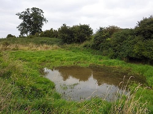
The Waveney is the more impressive river; it flows eastwards through the claylands and the Broads for 59 miles to meet the North Sea at Great Yarmouth. The Little Ouse is more modest and more obscure, and is just 37 miles long. It rises in the claylands then flows eastwards for four miles before entering the chalky and sandy confines of Breckland, through which it flows into the Fen basin. Its waters there dissolve into the Great Ouse, and hence go into The Wash. 


Swamp woodland at Blo' Norton Fen. A century ago this site was was open fen, but the progressive effects of
drainage and cessation of economic management for reed and sedge have allowed it to fall back to woodland.

In 2011, the Little Ouse Headwaters Project  (LOHP) commissioned the Sainsbury Centre to develop a creative group to explore artistic responses to this part of the valley. My contribution to this enterprise was a book. It weaves together text, photographs and images from many sources, and my fellow photographers are Gill Farlam, Mary Thompson, Sheila Tilmouth and David Whatley. We used the 19th century Albion hand press at Francis Cupiss Ltd to print the book's title.

The name of the book is 'Sources'. It is a multi-faceted phenomenology of water, touching on its ageless life in the valley and its relationship to people, places, plants and animals. It is also a tribute to the rewilding work of the LOHP in the five parishes of Blo' Norton, Garboldisham, Hinderclay, South Lopham and Thelnetham. Their habitat restoration work is stemming past ecological degradation in the valley, and helping to promote the valley's natural wealth. Its source is water.


'Sources' is published online, via print-on-demand (paperback or hardback formats), and is available at cost price.


Click here to see a book preview.


Sunday, 29 September 2013

Ducking Stool Meadow

I discovered Ducking Stool Meadow when I was 15 years old. I found its name on an old Estate map of West Hall Farm; it was shown as two long fields, a small stream and a pond. The stream is unnamed, but we may call it the Rickinghall Brook. It runs through a broad, shallow valley gathering water from West Hall farm and the high Suffolk claylands beyond.

Redgrave Estate map, 1856
My bedroom window was high up, giving a distant view of Westhall Wood - a large, dark rampart on the horizon over a mile away. I knew Ducking Stool Meadow was somewhere out in the intervening farmland, but as far as I could see there was only arable in the valley: a land of barley and sugar beet.

I have never been to look for the Meadow - that is, not until today. I am now 54 years old, so it has spent the last 39 years in my imagination, as a lurid site of manorial justice and misogynistic cruelty. Today I walked local footpaths and trespassed across arable land to discover the reality.

The Meadow is gone - replaced by a sugar beet field - and the stream is just a grass-choked ditch. The pond remains, however, next to an ancient looking hedge, and show signs of recent re-excavation, with mounds of vegetated spoil either side of it. The edges and floor have a thick growth of Reed Canary-grass. A large Red Fox sprang up and ran away at my approach; a Great Spotted Woodpecker was calling pic pic pic from a nearby oak tree; a young Moorhen splattered across the pond then loitered on the other side watching for a while - perhaps I was the first human it had ever seen close to. The pond has evidently a life of its own, and has been managed fairly recently, probably for duck shooting.


It is difficult to believe that this quiet spot may once have been witness to pitiful cries and jeering satisfactions. The roots of ducking as a punishment run back into the Middle Ages, as part of the justice administered by Lords of the Manor. There were three manors in Rickinghall: Westhall, Facon's Hall and Fitzjohn's. All three survive in title; the first two survive as the manorial farmsteads (West Hall and nearby Facon's Hall), but Fitzjohn's only survives as a field name. None of these sites are more than ¾ mile away from the Meadow, so perhaps the ducking stool was a joint manorial waterboarding resource.


Image by Pearson Scott Foresman, courtesy Wikimedia Commons

Although Sir John Holt (1649-1710) had terminated official witchcraft persecution in England, the practice was still condoned in more vernacular contexts. 'Swimming' a suspected witch took place as lately as 1825 at Wickham Skeith, a mere six miles away away. An old, itinerant pedlar called Isaac Stebbings was 'swum' in a pond, and subsequently died from his ordeal.

As I walked back towards West Hall a pair of Common Buzzards were soaring over the wood. The hedgerows were thick with autumn fruits - sloes, damsons, blackberries, elderberries, rosehips - and I passed a towering apple tree on an old field bank. I am glad to see that scraps of biodiversity still manage to hold their own in this intensively-managed agricultural landscape. Westhall Wood is a Site of Special Scientific Interest designated for its ancient oak and hornbeam woodland dating back to Mediaeval times, so that would be a place to visit. It is 80 acres (33 ha) in size, so I'd enjoy getting lost in its historical depths. Hopefully, I'd be able to find my way out again.


West Hall


Saturday, 1 September 2012

Archives and memory


I spent yesterday in the company of many old documents. They are the residues of the old Redgrave Estate and general family admin. Over 7,000 similar documents have already been catalogued by the Redgrave History Group, and there is already an archive in the Suffolk Record Office. While there is little family material of public interest, there is much information about local people and places over two centuries, and through them it is possible to get detailed insights into the life of villages such as Burgate, Botesdale, Hinderclay, Rickinghall and Wortham as well as Redgrave. The oldest papers go back to the 16th century, the most recent date from the 1970s, though most span the period 1780 to 1860. The residue has passed into my hands since my father's death, and it is my little task to sort it for posterity. Once catalogued, most of it will go to the Record Office and the rest into a box of family history.

The remains of Redgrave Hall, c.1955. The Georgian house was demolished in 1946,
leaving the Tudor core, with the eventual intention of restoring it. This never happened,
and these ruins were demolished c.1970. Photo courtesy Shaun Addy.

Drainage plan, C16th.
.
Here, I am inevitably drawn into the story of Redgrave Park. I first encountered it at the age of six. I was fascinated by the crumbling ruins of the Hall and its overgrown gardens, the rambling Park and beautiful lake. The impression made by that place has never left me. Who would not be amazed by such a place? The landscape had been designed by Lancelot 'Capability' Brown to catch the human eye and heart. My sister Pip and I swam in the lake, collected birds' eggs on the islands, explored the hollow oak trees; we picked plums in the overgrown gardens, visited 'Wop' Garnham in his keeper's cottage beside the lake, and had picnics at the Round House. The Park is a focal place in the Mythic Geography of my life.


From an Estate terrier, 1803
.
The Park was sold in 1971, when I was 12 years old; my parents split up and my mother moved to Scotland. As a teenager I pored over photographs, maps and plans, resurrecting the prelapsarian life of the Park in my imagination. 


Views of the Park, c.1935

We never lived at Redgrave Park, but it is still alive in my psyche, as if it were a cherished homeland destroyed by a War. I recently caught some words by author Jonathan Coe, speaking on the radio. I think they are a clear statement about the importance of 'place' in the psyche, and importance of personal memory in creating - and re-creating - it. 
"Sometimes I think that these spaces we inhabit are not physical places at all, just layer upon layer of memories. They are built out of experience - human experience - not steel or pre-cast concrete. A friend of mine used to live on the 19th floor of a tower-block near Liverpool. They knocked it down, but he still used to drive past that place every day, and look up into the sky and remember all the things he had done, the friends he'd met, the women he'd loved and lost - and all these in a few cubic metres of space which were now hung, suspended in mid air. When this place is gone what will be left of the people who lived here? That mound in the middle of the court, my court, Bobby's court, will be flattened, no one will remember it. No one will remember I met Susan there, fell in love with her, and when we were children we called that The Moon; and that other people lived within these concrete walls, had their own memories, had their own stories. It will all disappear, it'll all be lost unless we struggle to remember. Someone has to keep the records".
 (BBC Radio 4, October 7th, 2011)     

If I set fire to the Redgrave Estate papers nobody would ever miss a thing. But perhaps future generations would lose some richness which I have it in my power to give them. This archive is a resource of memory for other people's families as well as my own. The struggle to remember serves the future, but in doing so it also serves the people of the past. Someone could use the archive to resurrect the bare bones of past life, and through diligent research, give them flesh. Maybe I am standing with one foot in the land of massive unreason, but I feel as though I have a responsibility towards the dead and the places they knew. I have only a few more documents to catalogue, then I can hand their records over. My part in their resurrection will be done.


Redgrave Park today

Friday, 3 August 2012

The Seggs

Out on the boundary of a rural parish I have a sense of being anywhere, nowhere. Only the map tells me I am on a significant line, with perhaps a ditch or hedge to anchor this information to a sensed place.

I am standing on the edge of the shallow valley of the River Dove. It drains part of the plateau of central Suffolk, wending its way quietly northwards into the River Waveney at Hoxne. A jungle of bushes and marshy ground lies before me, rioting with nettles and reeds on an unkempt portion of the floodplain; local people call this area the Seggs. Other parts of the valley have open, grazed meadows and wooded margins, but the Seggs keeps an unruly isolation. It is fed by floodwater in winter and the discharge of a side valley, the Birdwalk Brook, little more than a ditch which drains the Eye Industrial Estate, a mile and a half away. It lies exactly on the parish boundaries of Eye and Brome & Oakley.

Aerial view, courtesy of Google Maps

.
My story began here in 1996, when the Environment Agency decided to deepen the channel of the Brook with a mechanical digger. The Industrial Estate was expanding, and more run-off was expected. I decided to look at the excavated spoil spread beside the ditch. At that time I was investigating local archaeology, by walking the fields owned by my landlord Mark Prior, and I had turned up Mesolithic, Neolithic and early Bronze Age flint work. I hoped to find more prehistoric evidence preserved in the peat and alluvium of the valley floor. I soon found animal bones scattered in the spoil, including cattle skulls. There were two slabs of Niedermendig lava quern stone, and a sherd of greyware pottery. I decided to look at the freshly cut walls of the ditch to see where this stuff was coming from. 
.
Peat and alluvium exposed where the Birdwalk Brook
entered the Dove valley. Summer 1996.
Over the course of two months I excavated a layer of compacted peat beneath the floodplain alluvium of the Dove, recovering bones from it (cattle, horse, pig, dog), also worked roundwood and evidence of a wattle fence, but no pottery or metalwork. Geomorphologist Alistair Pitty and soil scientist Bill Corbett helped me understand the sub-surface geometry of the peat and alluvium by hand-drilling a series of core-sampled transects across the basin. I explored the Brook a little way upstream and found evidence of a dumped clay dam spanning its valley. Since the sediments and fossil pollen at Diss Mere, five miles away, had been so well studied, I thought it might be possible to relate the environmental evidence here to a robust local framework going back 10,000 years.


.

Gradually the story of the archaeology and geology came together in some hypotheses about the history of the site. Far from being a quiet, forgotten corner of the Dove valley, the Seggs could tell a story of human business and environmental change.  
  • The animal bones came from a farmstead at the Seggs, possibly later prehistoric, and the peat dated from this time.
  • The arrival of farming in the Dove valley, possibly in the Iron Age, led to increased run-off from local fields, and hence deposition of the layer of alluvium over the peat. 
  • There was a mill sited where the Brook enters the Seggs, perhaps in Mediaeval times.
.


I wrote a simple report of my findings and gave the excavation archive to the Suffolk Archaeological Service for posterity. There it stayed until 2010, when I met Ben Gearey who was excavating the Iron Age site at Barsham in the Waveney valley, and I told him my story. We revisited the site, now much overgrown, and he took some wood samples for carbon-14 dating. 
.
The results dated the worked roundwood to 420-610 AD. So we have rare evidence of life in the post-Roman period in East Anglia - the time of early Anglo-Saxon settlement and the age of Arthur. 

This information has transformed my awareness of the Seggs. Somewhere here, on the boundary between the two parishes, there was a farmstead where people were born, lived and died. Perhaps they were Christian Britons, but they are more likely to have been among the pagan Angles or Saxons whose settlement sites are typically found along the valleys of Suffolk. I am reminded of West Stow in the Lark valley. Perhaps they buried their dead in the cremation cemetery discovered in 1818, a half a mile away at Waterloo Plantation. They lived in the days before Christian parishes, and when the boundaries were drawn here, perhaps in the 8th century, the existence of their homestead may already have been forgotten. People had moved by then to village centres on higher ground, leaving the valley to its pagan desolation - its trees, meadows and wetland - much as we see it today.
.
The Seggs reminds us of an abandoned ancestral geography, and when I walk there my awareness is dense with all the silent memories written into the sediments of the valley floor, which only excavation could give a voice to.


Tuesday, 17 July 2012

Grimes Graves

Few places in Norfolk have more mystery attached to them than Grimes Graves.
.
Its name, for a start -.'Grim's Diggings', in which Grim is one of the titles of the old English god Woden (Odin), meaning 'masked', 'atrocious' or 'cruel'. .
.
Dirt is grime and dirt is grim, and so are graves; one walks away from them wiping one's hands. The name comes down to us from the Dark Ages, as though the place were best avoided.
.
The site is a lonely cluster of pits and mounds on open heathland surrounded by forestry plantations. In some ways the place itself is an anti-climax for visitors. How could it ever live up to its name? An English Heritage visitor centre squats in the middle of the site, housing introductory displays and a range of gift items, such as wines, jams and wooden swords. One is obliged to wear protective clothing before descending the ladder into the only open mineshaft. Once below, some 30 feet from the surface, with eyes adjusting to the dim light, one finds a series of low, lit tunnels and chambers radiating outwards into the surrounding chalk bedrock, from which slabs of flint were extracted by late Neolithic and early Bronze Age miners. The entrances are blocked with iron grilles and the chalk is grouted with white concrete - a far cry from the days of my childhood when I could scramble down the tunnels, and emerge covered in whiteness, my hands scratched by flints. 
...
Grimes Graves gallery © Tim Holt-Wilson 2012

I first met Grimes Graves through the historical dioramas at Norwich Castle Museum. They uniquely opened my eyes to Norfolk's history. The most compelling and disturbing model was that of a semi-naked man with an antler pick in hand, twisted awkwardly and bleeding, hacking out flints in a flickering darkness. I found his vulnerability frightening. I could turn with relief to the next diorama of the series, a sunlit Breckland scene during the Bronze Age. These displays have been 'retired' in recent years, but their impact remains. It is rivalled by that of the dark reconstructions of the site by Alan Sorrell, commissioned by the Ministry of Works in the 1960s, with their grainy atmosphere of prehistoric despair. 
.
Grimes Graves landscape © Tim Holt-Wilson 2012
.
Last Saturday, I joined the Hertfordshire Geological Society at Grimes Graves for their Breckland field trip. I was asked to say a few words about the site, so I spoke to them of trading networks and flint, heathland and vegetation patterns. But while members descended into the pit, I explored the pockmarked landscape above. The turf is soft and enchanting, like downland, and is cropped by primitive-looking sheep. Some 400 craters are scattered across the site, each one pays homage to Man's ancient and powerful ally, flint, and beneath each is an unexplored deposit of chalk rubble and prehistoric debris with a story to tell. I suspect it was from a place such as this that the maggots hatched from the Earth to become the race of dwarves, 'who acquired human understanding and the shape of men' ('Gylfaginning', XIV).
.
However, a horse's skull is my strongest association at Grimes Graves - the skull of a mare of Bronze Age date. It was recovered during the British Museum excavations in the 1970s, and represents the earliest known domesticated horse in Britain. She was evidently old at the time of her death, for her teeth were worn. Exotic and valuable, she was evidently worth caring for into old age. I think of her as the ancestress of all native horses in Britain. She doth appear in my imagination ghastly white, covered in chalk. 


Sunday, 8 July 2012

Monoculture

Rushall, Norfolk - 7th July 2012

A warm wind from the south-east, with disturbed cloud shifting through a blue sky - change is in the air in this part of England, while other parts (Devon, Dorset, Somerset) experience torrential rainfall. Fields of corn and sugar beet are basking in shifting sunlight.

Rushall landscape 1 © Tim Holt-Wilson 2012

I am walking along a footpath southwards towards Dodd's Wood. The path follows a strip of grassy land, a set-aside or conservation margin, between a wheat field and a hedge. In contrast to the block of uniformly coloured wheat to my right, the field margin and the hedge are alive with a variety of insect and plant life.
  • A dusky brown butterfly with slow erratic flight, grey margins to its wings;
  • A copper-coloured butterfly, wings ajar as it rests on a leaf;
  • A fleshy looking water plant with spear-shaped leaves in the ditch;
  • Flowering grasses;
  • Pale pink, sweetly-scented dog roses like stars in the hedge;
  • A large puff-ball seed head like a dandelion clock but much larger and bolder; has green flower buds...
I search for names to make sense of what I am seeing in the landscape. Sometimes the particulars are there, and sometimes they are not: .
  • A big humming insect > a bumblebee > White-tailed Bumblebee Bombus lucorum.
  • A wood > a square of deciduous trees > perhaps a plantation 200 years old.
  • A field of corn > wheat > I don't know the name of the seed variety (how can I find out)?

A Small Skipper butterfly Thymelicus sylvestris
The dramatic leaves of Water Plantain Alisma plantago-aquatica
.
The sheer diversity of the life along the hedgerow and ditch contrasts absolutely with the lack of diversity in the wheat field. A regiment of stalks rise regular and stiff from the bare brown soil. A small moth flies up from my feet and lands in the wheat. Frankly, I am a little afraid for its safety, as if the wheat were laced with pesticide - which it probably is. From a biodiversity point of view, if we could see the field as a painting then the frame would be the most valuable part of the tableau. 
.
I pause on the threshold of the wood, my eyes adjusting to the dim, green light and my skin to the change of temperature. Tree trunks rise up, giving contrasting vistas into deeper places beyond the path. Pale brown, voracious sparks of life - mosquitoes - begin drifting round me. I follow the footpath across ground carpeted by Dog's Mercury and Enchanter's Nightshade, flanked by traces of a ditch brimming with leaf mould. Through the trees, I see that many branches have been gathered into a conical shelter round the base of an ash tree, as if adventurous boys - or Mesolithic man - had recently passed through. It is more likely to be a rough shelter for feeding pheasants in winter.
.
.
In contrast to the wheat field, the hedgerow, ditch and the wood are places of richness - visual, cultural and biological. They have developed in a time-depth dimension, as years and centuries have passed by with ecological continuity. There are occasional punctuation marks in their development - cutting, ditching, coppicing - but nothing compared to what happens to the wheat field, reset to ground-zero each year by the farmer. 
.
Of course, all this land was once forested, perhaps a thousand years ago, and the fields were won from the forest by hard labour of humans, horses and oxen. The diversity of life in the field margins, hedgerows and ditches has developed since then. I am thankful for the Environmental Stewardship scheme which allows it to continue flourishing in the face of industrial agriculture. If the wheat field is 'modern', perhaps the conservation margin is 'postmodern'? (answers below, please).
.
Meanwhile, I am reminded of a quote by the anthropologist Claude Lévi-Strauss:
.
...civilization is no longer a fragile flower, to be carefully preserved and reared with great difficulty here and there in sheltered corners of a territory rich in natural resources... All that is over: humanity has taken to monoculture, once and for all, and is preparing to produce civilization in bulk, as if it were sugar-beet.
                                                                   - 'Tristes Tropiques'; transl John Russell; 1955.
..
Rushall landscape 2 © Tim Holt-Wilson 2012

Wednesday, 27 June 2012

Hrēod Græf

I was in Redgrave yesterday evening, at a meeting hosted by the Culture of the Countryside project of the SCVA. We discussed ideas for creative collaboration with the Little Ouse Headwaters Projectwicker eel trap stood on the table, along with a terracotta statuette of a Mexican rain god and the prow of a Polynesian canoe. 
.
Including both wooded uplands and valley fen, Redgrave was called Redegrafe in the Middle Ages, from the Old English Hrēod Græf, 'Reed Ditch'. So it probably started life as a settlement down near the Fen, perhaps on on the sandy soils round Moneypot Hill. The main area would have developed later around the Green,  perhaps in the 12th century, a mile away on the clayland plateau. Redgrave has strands of continuity with the Mediaeval world, with relics that include its Green, Church and Park (which once belonged to the Liberty of St Edmund), its Lord of the Manor, and the pattern of its roads and lanes. It also has its people, many of whom may be more local than they know, and of course its plants and animals - the parish is their homeland too.

Hodskinson © Tim Holt-Wilson 2012
Extract from Hodskinson's map, 1783,
showing Redgrave Green and the Fen
.
How can we creatively engage with the local distinctiveness of the Little Ouse headwaters area? The river starts life as a ditch in Burgate or Rickinghall, depending on which way you are looking. It swells with groundwater seeping out of the Chalk bedrock and boulder clay. Its valley is the westerly part of a former glacial meltwater channel fifty miles long joining the Fenland basin to the Waveney. Seen from the air, it is a rank green corridor of grazing meadow and marsh, carr woodland, fen and even patches of heathland. Its resources down the centuries have been a province of the poor: it has supplied them with timber, peat and firewood; hazel and furze; wicker, reed and sedge; meat, fish and nuts; even pools for retting hemp. Like Hrēod Græf, local parish names evoke the ancient life of the valley: 
  • Blo' Norton - Blaenorton – ['North farmstead where woad grows']
  • Hinderclay - Hyldreclea – ['River fork where elder grows']
  • Thelnetham - Thelfetham – ['Village frequented by swans']

Marsh ochre © Tim Holt-Wilson 2012


After the meeting, as dusk was falling, Justin [Partyka] and I set out towards the Fen down the footpath of Mill Lane. We met Neville Culley out walking his dog. He has lived all his life in the village, and was brought up at Sandyhurst cottage near the Fen; his father Eric was the Redgrave Estate carpenter. We talked about people and places. Later, Justin and I continued towards Sandyhurst. The footpath skirts the wood, where Eric said the nightingales once used to sing so loud they kept you awake. We passed the lighted windows of the lone cottage where his widow Daphne lives. Neville clearly makes himself useful about the place: the grass in the lane is kept as immaculately as ever; its clippings are tipped in a huge navel-pile against the hedge, towering up beside a neatly trimmed ivy bush. Sandyhurst is an empire of order in the chaos of June.

Mill Lane finishes at the Fen. Dark trees give way to a gloomy expanse. A large hawk suddenly darted towards us, veered up and turned away - perhaps a Goshawk (Cully?). A crescent moon appeared between shifts of  cloud, eyeing us also from the surface of pools. In autumn, this part of the Fen is swept with 50,000 wings, as flocks of starlings twist and turn in dark acrobatic masses before settling to roost. The brooding stillness and otherness of this valley landscape challenges us to find messages that people will want to hear. It is liminal and borderline; its messages are unhuman. Would our tribal ancestors have seen it any differently?

Picking our way back up to Redgrave, the cottage windows were now in darkness.

© Justin Partyka 2012
Photo courtesy Justin Partyka

Friday, 1 June 2012

A Suffolk Expedition


I spent yesterday in the delightful company of Justin Partyka and two American guests Judith Stark and Donez Xiques. We explored the pre-Enclosures landscape of Mellis, Burgate and other parts of the old Redgrave Estate. The ghosts of Roger Deakin and the spirit of Oliver Rackham were rarely far away, both people who knew the area. The rain was also our companion.

A hornbeam stool in Burgate Wood,
last coppiced perhaps 60 years ago.
This part of Suffolk is thick with commons and greens, ancient lanes and woods, the elements of the pre-Enclosure landscape which have somehow survived in this part of the county. Two centuries ago, the Enclosures impacted on the old landscape by dismembering commons and open field systems, for example the now-vanished Allwood Green and North Field at Rickinghall. Meanwhile, the villages of Mellis and Burgate remain clustered round their greens and linked by trackways; Burgate still has its Mediaeval wood, complete with original bank and ditch, 'giant coppiced stools' and the earthworks of a lost moated manor; Mellis still has its mile-long Green. The diversity of the plant life in this landscape is a measure of how long such traditional features have existed - the Dog's Mercury along the lanes, Herb Paris and Oxslip in the woods, for example.

Away from the woods, greens and lanes, however, the usual clayland agri-prairie holds sway, except where old-fashioned mixed farming is practiced. A shift in the rural economy in the 1970s destroyed far too many ancient features. Pointless agricultural greed became the order of the day, fuelled by EEC subsidies. In Mellis, Cowpasture Lane was removed south of the railway; Stonebridge Lane was removed between the Green and Whitmore's Wood. In Hinderclay, some 60 acres of the Wood was removed. Over half of Redgrave Park was converted into arable. Within a few years, many parts of my childhood's landscape became unrecogniseable. Local inhabitants were disgusted and inflamed; some, like Roger, took up arms in defence of the vernacular landscape; they battled at planning meetings and founded local protest groups, as at Botesdale. They found (in the short term) that they were powerless to do anything but rage in the face of the destruction. Roger's experiences here led him to become a founder of Common Ground. Writers such as Marion Shoard challenged the regime of rural land ownership ('The Theft of the Countryside'; 1980).

Stonebridge Lane 1904  (Ordnance Survey, 6" : 1 mile)
An ancient drove way between Burgate Little Green to the north, and Mellis Green.
An enigmatic avenue of trees leads south from Furze Way, and merits a landscape archaeological investigation.
Stonebridge Lane 2011 (courtesy of Google Maps)
Stonebridge Lane has been removed south-east of Whitmore's Wood, as have many hedges and ponds.
All traces of the avenue have also gone, though it remains a public footpath.

As these photographs show, the loss of local landscape detail between 1904 and 2011 is not just a loss of ecological richness; it is also a loss of historical richness and meaning.

How many people know what has been lost? How many appreciate what survives? A visitor may travel through the landscape of High Suffolk and complain that it is flat and boring. We need to tell them the truth: the beauty is in the detail.